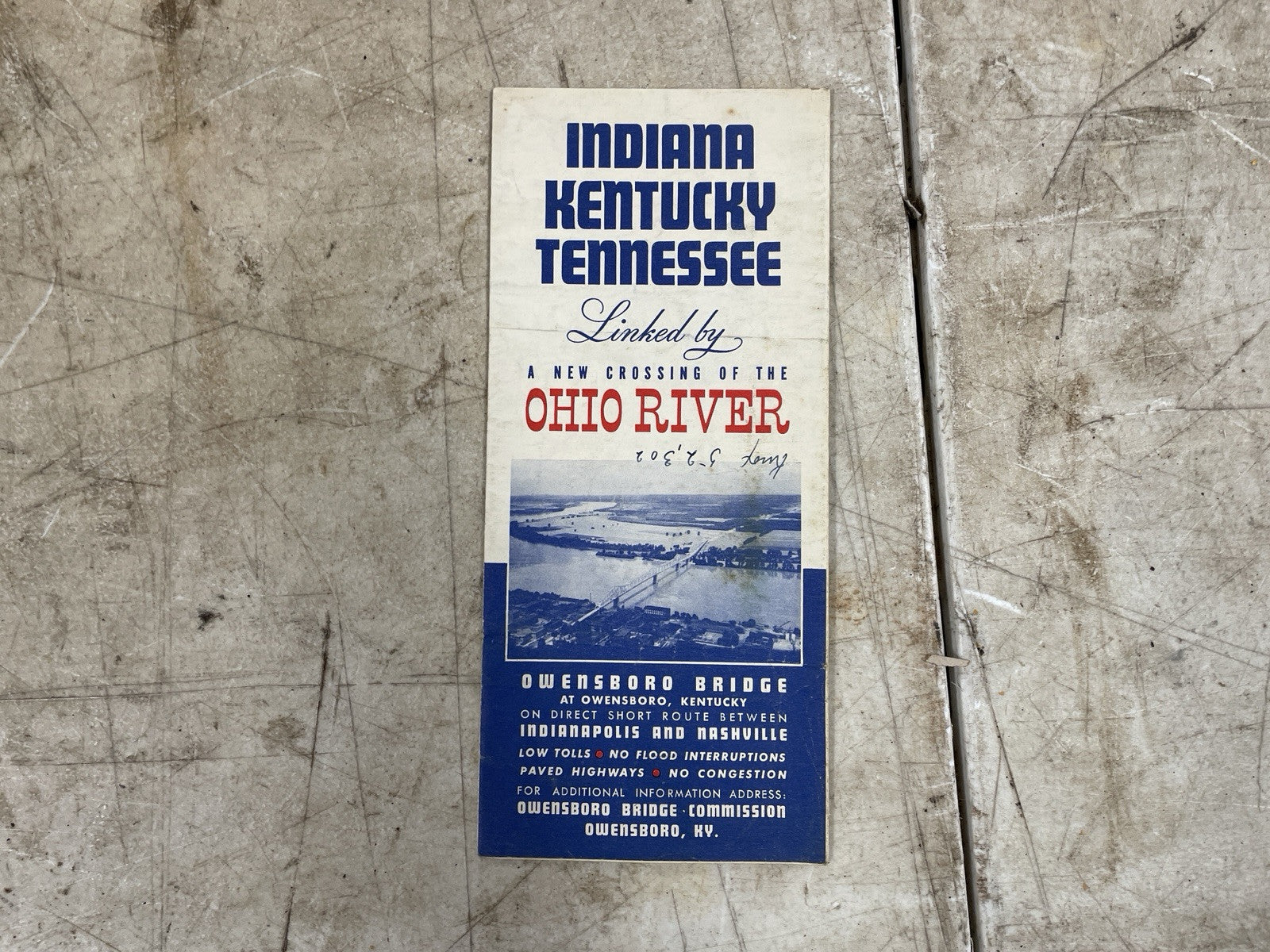
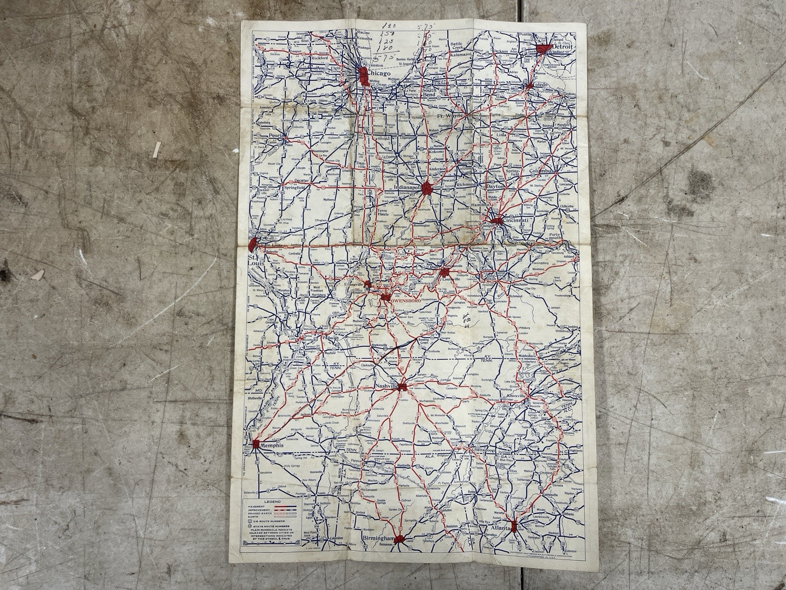

1940's Map "Indiana, Kentucky, Tennessee Linked by Ohio River" #44
$10.00
Unit price
/
Unavailable
Couldn't load pickup availability
This is a vintage map from the 1940s depicting the linked regions of Indiana, Kentucky, and Tennessee via the Ohio River. The map is a great addition to any collection and is perfect for those interested in history and geography. The item is a brochures and falls under the category of collectibles, paper, and maps. The map is not modified and was made in the United States.
